When our flight from Jeddah touched down in Singapore, it was the first time that I returned to my birthplace in more than twenty years, and much had changed.
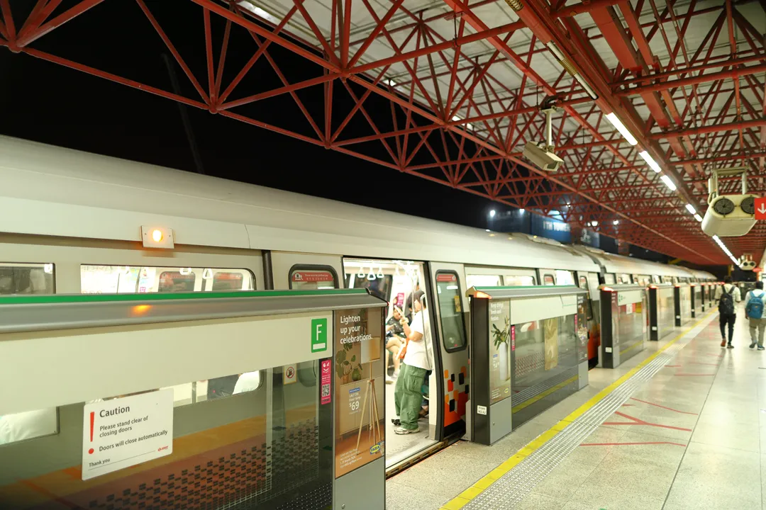
First of all, we rode the metro (or MRT) from the airport. Singapore was the first country in Southeast Asia to construct a metro system, and growing up with easy access to public transport had a profound impact on how I prefer to travel. The network has been expanded greatly and now has six lines instead of the two in the 1990s. However, we only needed to use the old East-West Line to reach Jurong East, where we would be staying.
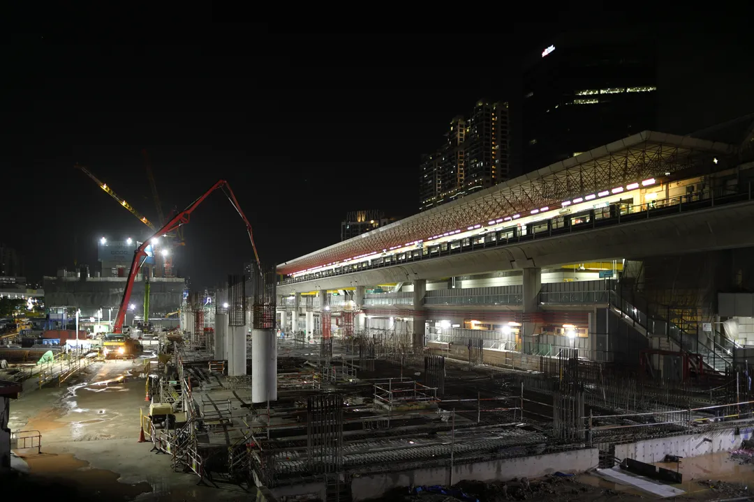
Although Jurong East is actually the busiest station in Singapore, normal tourists preferably should not stay so far from the city center; I only chose it because it is the closest place to where I grew up that has hotels. Even so, the area has undergone significant development. There used to be only a large empty grass field to the southwest of the station, but now the entire plot of land is a construction site for future expansion of the station to accomodate a new line.
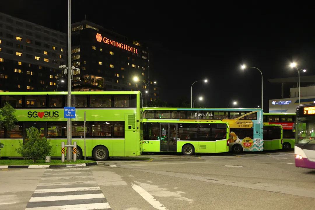
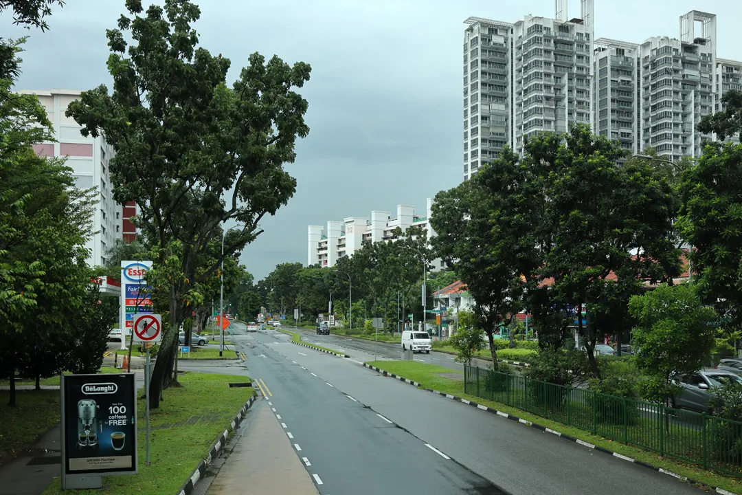
We passed the bus interchange on the way to the hotel. The classic red and white livery of the buses has long since been replaced by an ugly neon green one. Incidentally, buses in general have become a less important means of transport because the metro now reaches most places in the country.
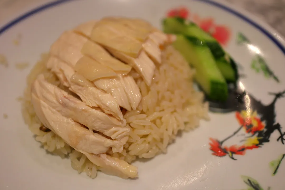
There was not a lot of time for dinner, but we managed to find Hainanese chicken rice.
The next day, we went two stations north to Bukit Gombak, from where it is only a short walk to the place where my family lived during my childhood: Block 325 Bukit Batok Street 33. Aside from a new coat of paint on the buildings, everything still looked more or less the same to me.
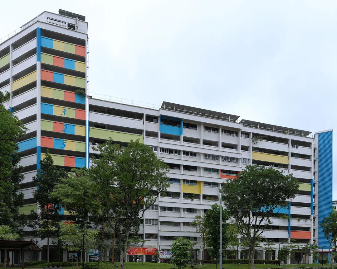
The blocks here are of older designs and have open corridors, which can be freely entered.
My family lived in the easternmost unit on the tenth floor. The view from the corridor remains similar, except for the cluster of newer buildings in the distance, on the other side of the metro tracks.
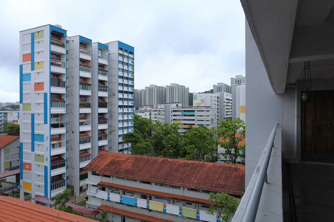
As a child, I used to play in the public space around the buildings, but there are hardly any people outside now (either children or adults), which is a bit of a shame. I also noticed that the playground in between Blocks 325, 327, and 328 has been removed and replaced by a simple plaza. This may indicate that there are simply fewer children in Bukit Batok, even though the total population has increased by 30% since 2002.
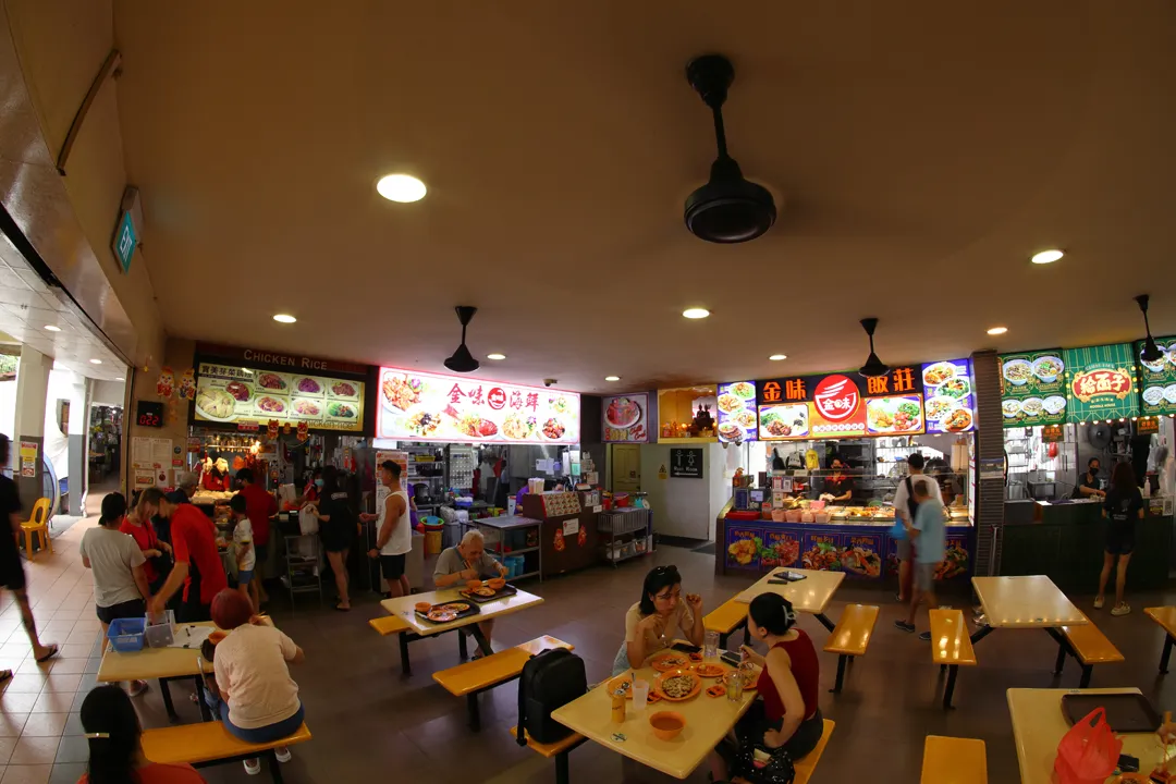
We ate chicken rice again in a hawker centre near the station. There was more activity here. Interestingly, places like this lack air conditioning even today.
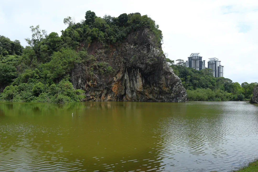
On the other side of the station, there is a park known as Little Guilin, being vaguely reminiscent of the famous scenery in Guangxi, China. Unlike the real Guilin, this one is man-made; it was originally a mine which was abandoned and subsequently flooded.
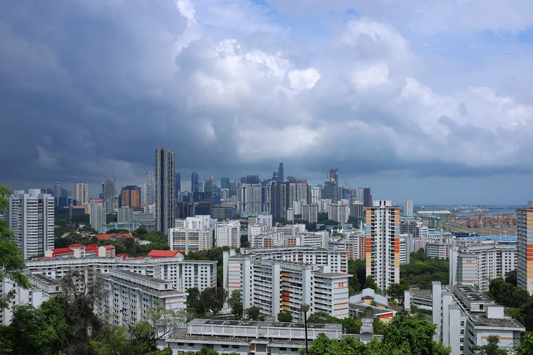
I had reached the day’s quota for nostalgia, so we waited out the hottest part of the afternoon and then proceeded to the city center using the East-West Line again. Sadly, the metro is not as interesting to ride as it once was because the elevated sections have been retrofitted with noise barriers that block the view.
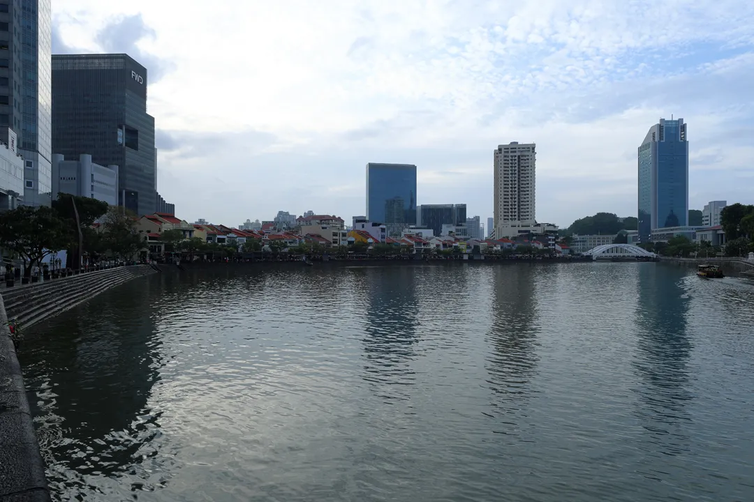
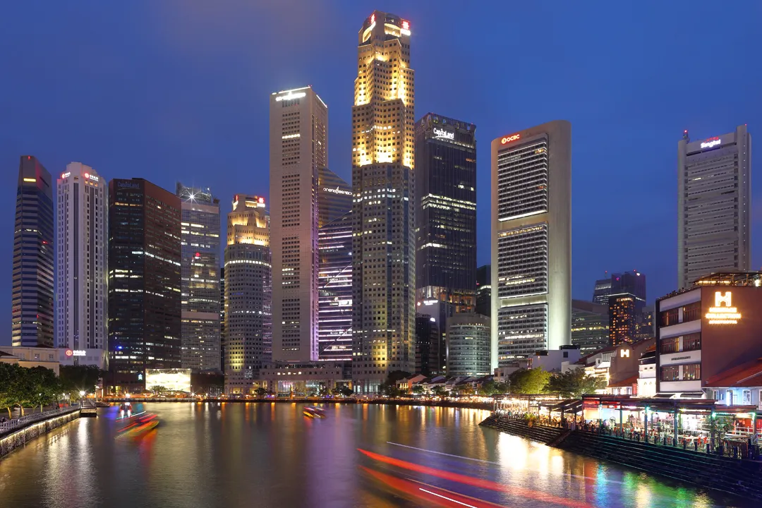
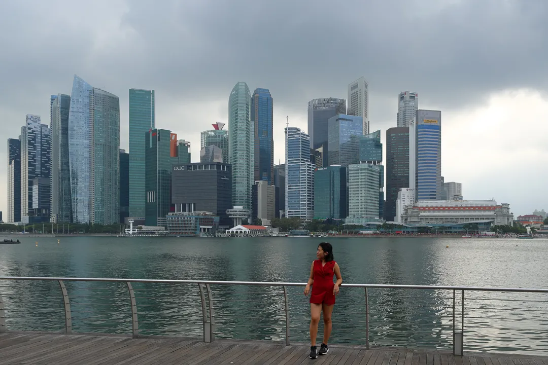
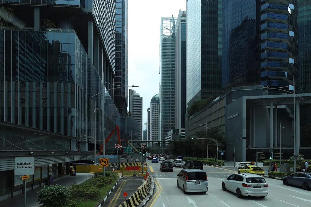
The skyline has seen some additions, but the UOB Plaza and One Raffles Place remain the most visually distinctive buildings. Also, the bay was converted from saltwater to freshwater by constructing a dam at the entrance, which was a revolutionary idea to increase the country’s water supply.
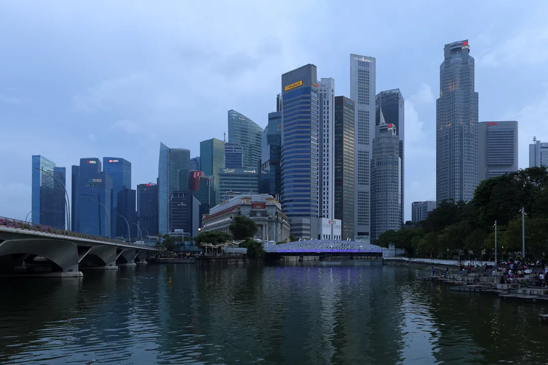
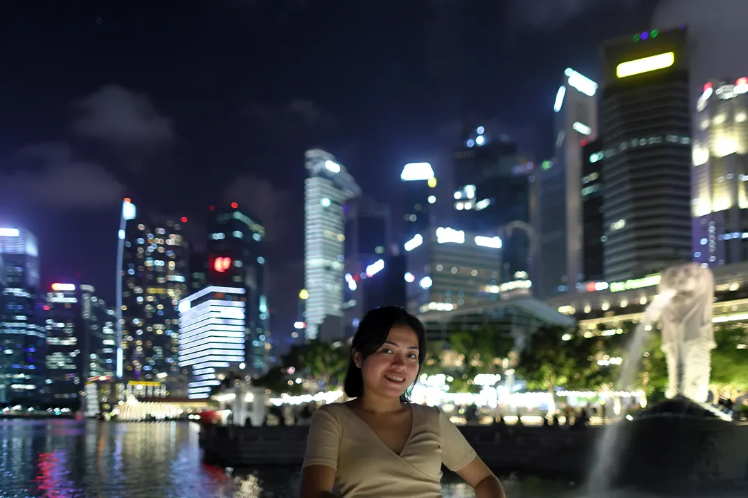
The vicinity of the Merlion statue and the mouth of the Singapore River is the most well-known place for tourists, and easily becomes crowded. We walked upstream until the Elgin Bridge, where the skyline can be seen over the river. Arguably, the view from the Elgin Bridge is more aesthetically pleasing than from the Merlion Park because it has more symmetry, and there is an additional benefit of few tourists getting in the way.
We ate dinner in the adjacent Boat Quay area, which is characterized by low-rise shophouses from the colonial era. These narrow buildings with white walls and red roofs are among the most recognizable examples of historic architecture in Singapore.
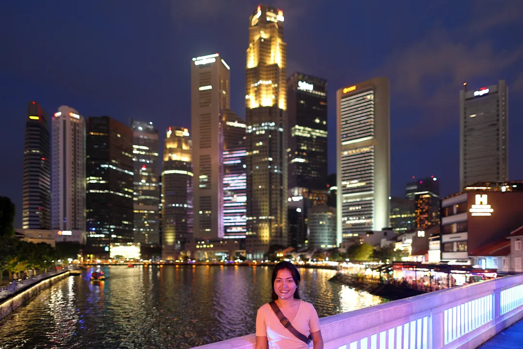
Later, the crowds at the Merlion statue had thinned somewhat, but while there was enough space to take photos, it would not have been comfortable to stay for long.
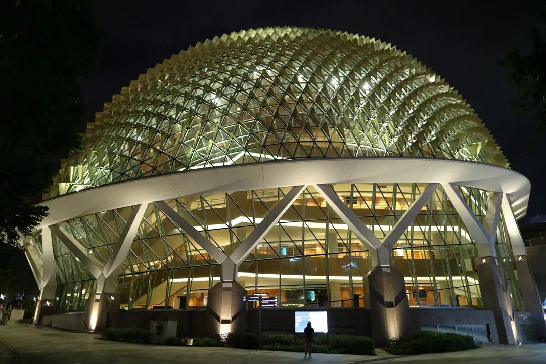
Before going back to the hotel, we briefly dropped by the durian-shaped Esplanade Concert Hall. I had never actually seen it before as it was completed in October 2002, shortly after my family left Singapore. During the day, its aluminum exterior makes it look silver; the lighting at night adds the final touch to make it more closely resemble a durian.
On the second morning, we went to Gardens by the Bay. However, I could only describe it as underwhelming. It is simply not that special in a country where parks and green spaces can be found virtually everywhere — the result of visionary urban planning policies. Long before Gardens by the Bay existed, Singapore had already earned the nickname “Garden City”. To be fair, it should still be of interest to the majority of visitors since few other cities in the world even come close to Singapore in this regard.
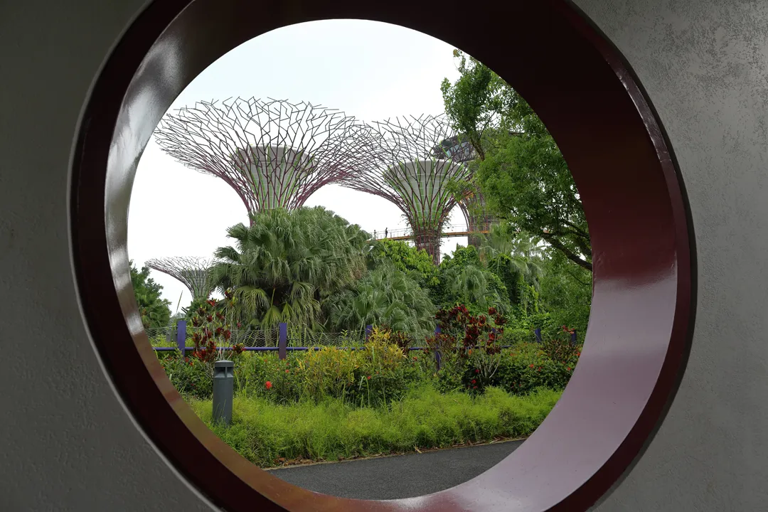
It did not help that some facilities were closed for maintenance and that it was raining sporadically. We instead spent most of our time at the mall in the nearby Marina Bay Sands. The most expensive building ever constructed in Southeast Asia, Marina Bay Sands cost nearly five times as much as Malaysia’s Petronas Towers. From its waterfront area, there is a novel skyline view, albeit one where the most iconic buildings are not prominently visible.
Having a lot of time remaining, we rode a bus back instead of the metro. Buses are significantly slower, but they have abundant seating and provide much better visibility from the windows, especially in the front. This makes them the best option for leisurely sightseeing.
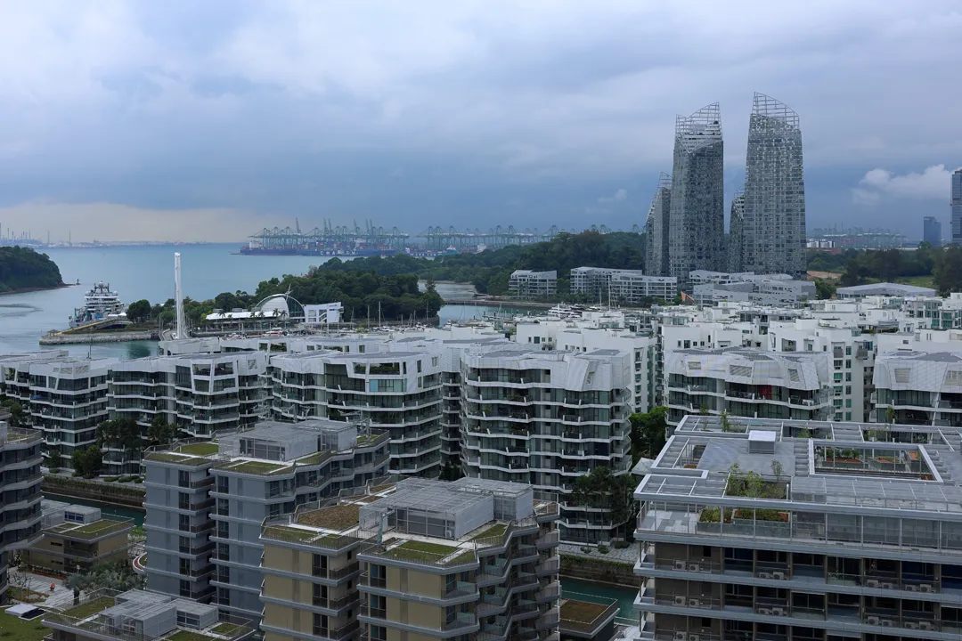
We began the last day by going to ride the cable car starting from Sentosa, a place whose character has changed significantly since the early 2000s. It is now much more built-up and commercialized, though admittedly easier to access as there is now a nearby metro station at HarbourFront.
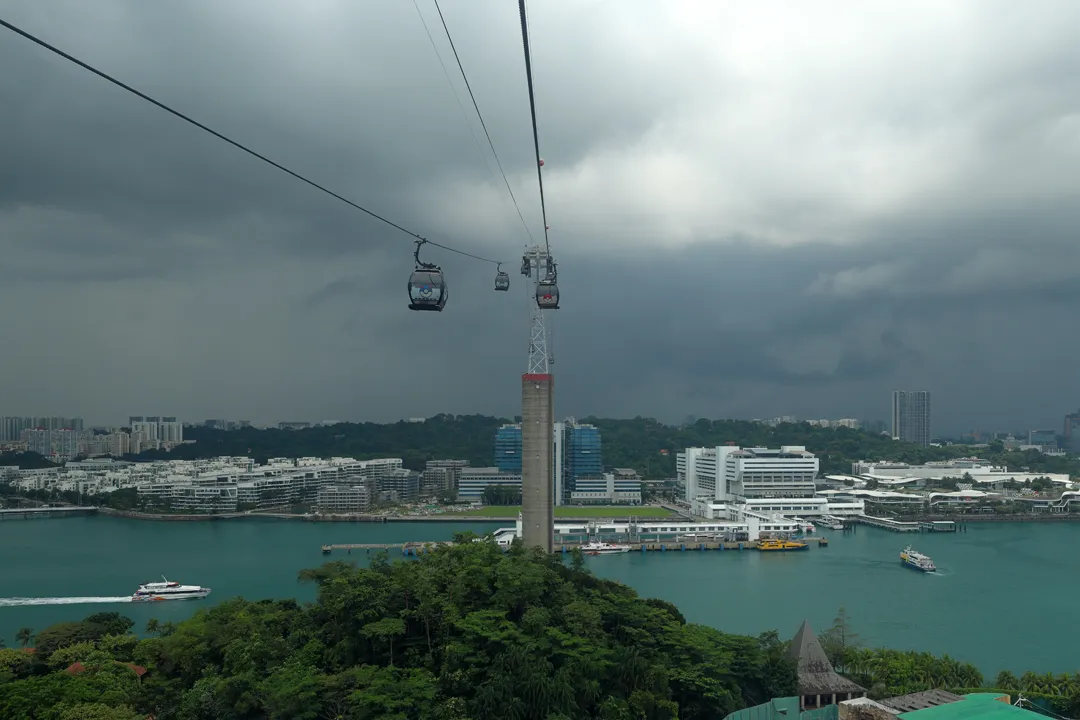
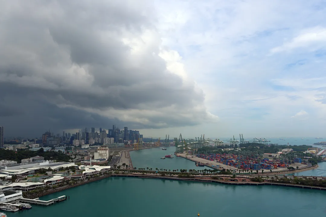
With a price of S$33 for a single round trip, tickets are fairly expensive (equivalent to at least 13 metro rides), but the experience is far more interesting than the alternative option of climbing Mount Faber on foot. During the ride, the skyline and container terminals can be seen to the east.
At the Mount Faber terminus, there is a restaurant and souvenir shop, but also good views outside. For some reason, it was much less crowded there than on Sentosa. Perhaps the cable car, now more than 50 years old, has already fallen out of favor, and people instead prefer the entertainment facilities in the resorts?
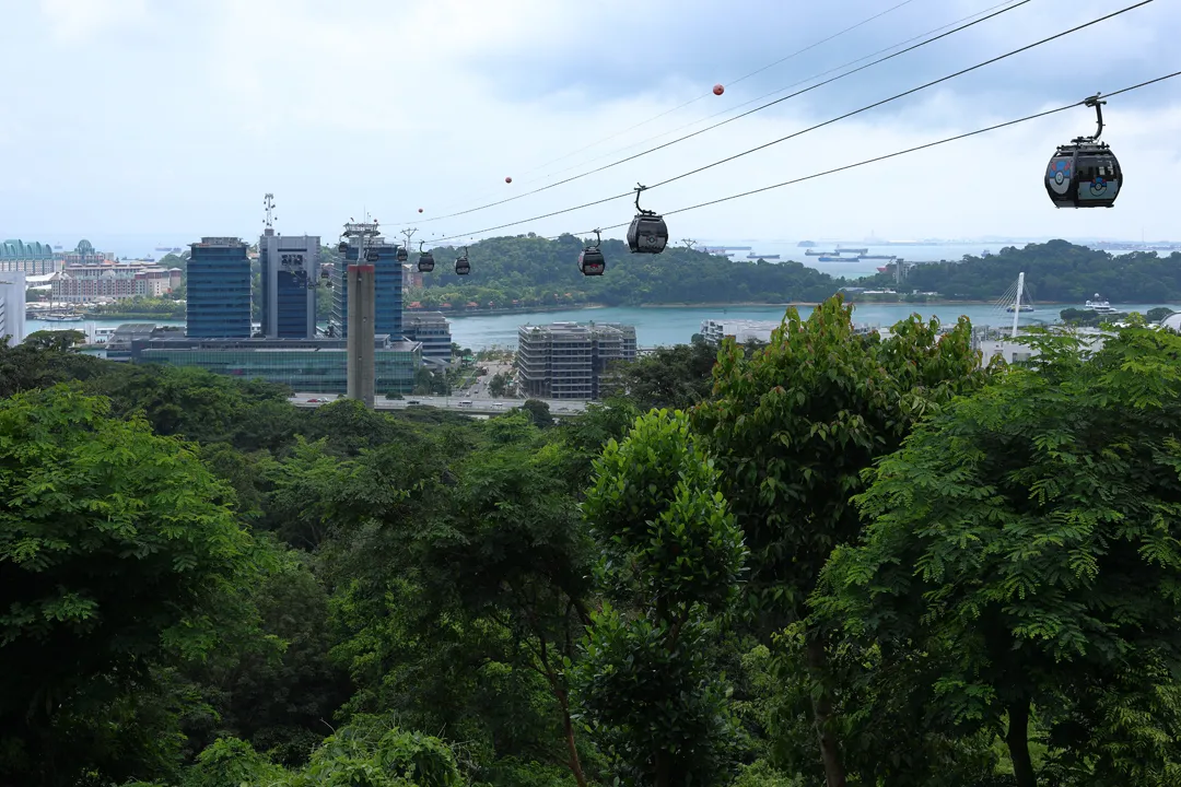
The highest point of Mount Faber has an elevation of merely 94m, which is exceeded by many buildings in the city, but the surrounding areas mostly consist of residential blocks from the 1970s that only have 12-15 floors, so the view is not obstructed.
Even the narrow strip of land on the south side, sandwiched between the hillside and the sea, is entirely developed now.
25 years ago, there was hardly anything there.
After checking the various vantage points, we rode the cable car back to HarbourFront and departed by bus. It was early afternoon, and the bus was pleasantly uncrowded.
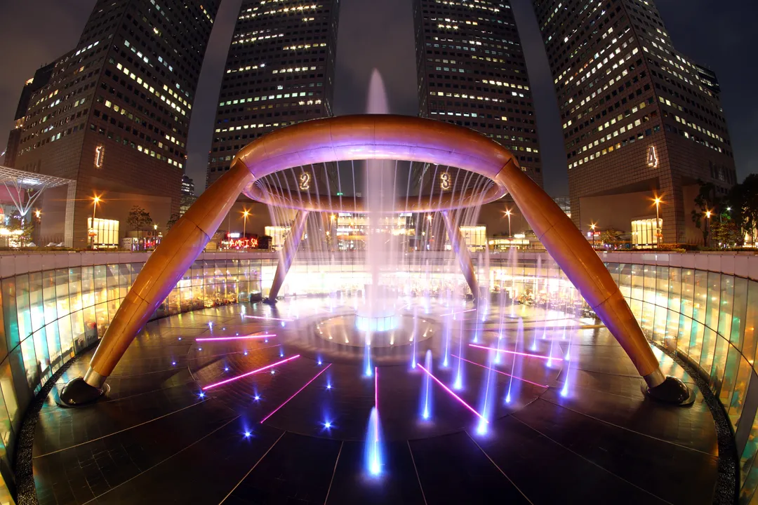
Our final stop in Singapore was the Fountain of Wealth, located at the Suntec City mall. The name of this circular landmark is quite appropriate; Singapore has by far the highest GDP per capita of any Asian country and trails only Luxembourg, Ireland, and Switzerland globally.
It is possible to go inside, below the fountain, when the water is not running. This may also have been allowed in the past, although I only remember seeing it from outside as a child. We did not have to wait long until the next available time to enter.
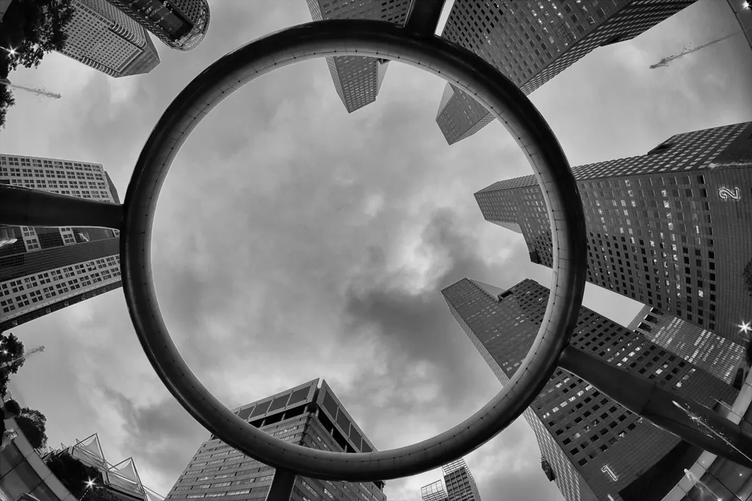
While the fountain’s scale is impressive from this perspective, it still looks the best from ground level when illuminated and the water is flowing. Compared to my memories, it is brighter, shinier, and more colorful — a description that could be applied to much of Singapore. But at the same time, it could not be clearer that the country’s identity has not dulled over the years.